10 Hands-On Activities for Teaching Colorado Geography
Teaching geography can sometimes feel a little dry. Not just for our students but even for us as teachers! When we take the time to understand the lay of the land, it helps us connect with the experiences of the people who lived there. As I worked on developing my Colorado curriculum, I made it a priority to include hands-on activities that would make teaching Colorado geography exciting and engaging for everyone. Today, I’m sharing some of my favorite activities that help make geography memorable.
Why Teaching Colorado Geography Is Important
When it comes to teaching Colorado geography, it’s so much more than just memorizing maps or landmarks. Geography lessons help our students better understand the world around them and their place in it. They begin to see how an area’s physical features shape how people live, work, and interact with their environment. For example, as students learn about Colorado’s diverse geography, from its towering mountains, expansive plains, and rushing rivers, they understand why certain towns thrived as mining hubs while others became agricultural centers. It also helps them connect historical events and cultural traditions to the land, giving those stories a stronger sense of meaning.
Geography is often an overlooked subject, but it holds so many answers. For instance, understanding why mines and ski areas are close to each other becomes common sense when our students explore the terrain and natural resources. Knowing where crops are planted reveals so much about an area’s weather, soil, and climate. If we take a closer look at roads and rivers, our students start to understand how people and goods travel throughout the state. Geography explains so much about economics, psychology, weather, and more. It’s truly fascinating!
Beyond the facts, it builds critical thinking and problem-solving skills. When our students explore the “why” behind historical events, they begin to see the role that geography plays. As they dive into geographical patterns, they start seeing human impact on the environment and how communities adapt to their surroundings. That’s why weaving engaging geography lessons into our classrooms is so important. It’s not just about knowing where things are. It’s about understanding the why behind it all.
Resources to Help With Teaching Colorado Geography
In my paper and digital unit for teaching Colorado geography, we start with the basics to build a solid foundation. Through this unit, students will be able to find Colorado on a map and globe, understand its regions and physical characteristics, and identify a variety of landmarks and historical locations. But they are also going to dive deeper as they explore how the geography of Colorado affected life in the past, and how it will affect the future.
With a variety of hands-on and interactive activities, your students are going to love learning about the rich geography of Colorado. Let’s take a peek into all this unit holds.
Where is Colorado?
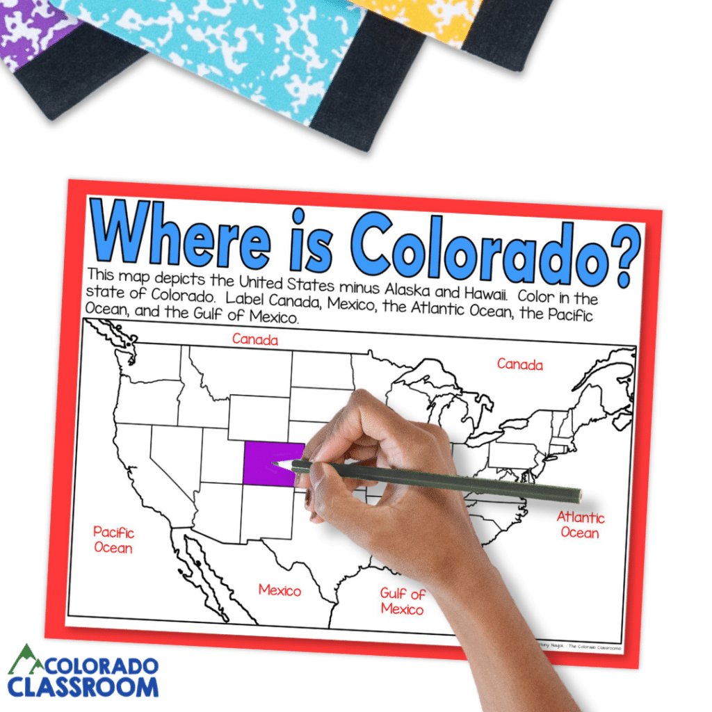
We kick things off by helping our students locate Colorado within the United States. This activity uses a simplified map of the U.S., excluding Alaska and Hawaii, to keep the focus on the contiguous states.
I start my students off by having them color in Colorado. This helps create a visual link to the state’s shape and size. Then, they label other important geographical features like Canada, Mexico, the Atlantic Ocean, the Pacific Ocean, and the Gulf of Mexico. This activity is an excellent way to teach Colorado geography, laying the groundwork for understanding its relative position to the country and its neighboring features.
What Region Is Colorado In?
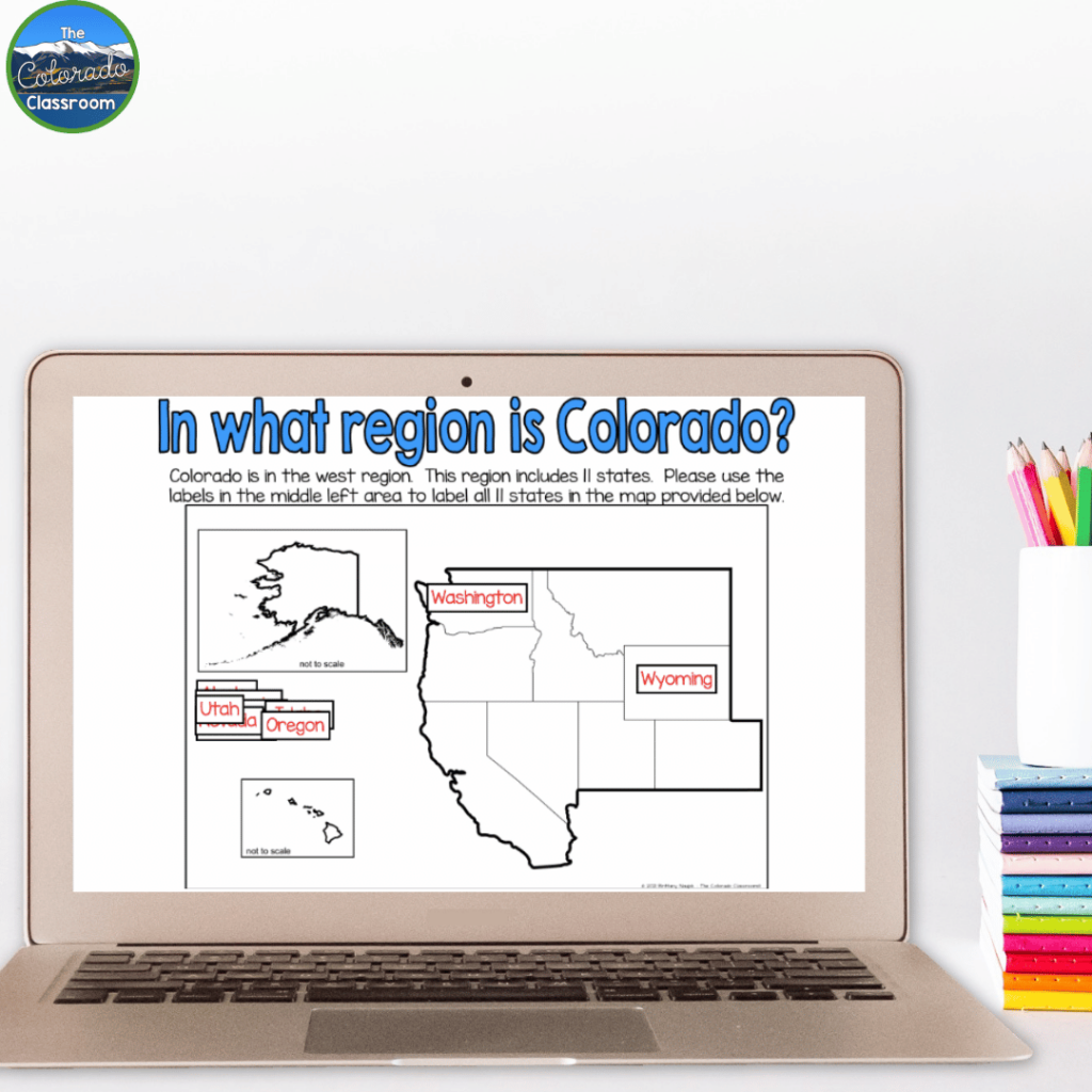
Once our students have identified Colorado, we zoom out to explore its place within the western region of the United States. Using a detailed map, our students label all 11 states in this region, reinforcing their understanding of state borders. As part of this activity, I encourage them to make observations about how the western states share similar landscapes, climates, and even historical industries like mining and farming. This activity makes teaching Colorado geography engaging by showing our students how Colorado fits into a larger regional context.
The Four Corners
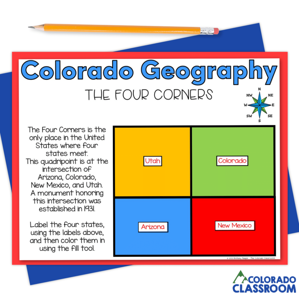
One of the most exciting aspects of Colorado’s geography is the Four Corners. It’s the only place in the U.S. where four states meet! Our students work on a map to label and color Colorado, Utah, Arizona, and New Mexico. We also chat about the historical and cultural significance of the Four Corners Monument. The monument was established in 1931 to mark this unique intersection. To take it a step further, I ask students to imagine what it would be like to stand in all four states at once, tying personal engagement to the lesson. This activity is one of the highlights of teaching Colorado geography, as it combines hands-on learning with real-world connections.
Political Map
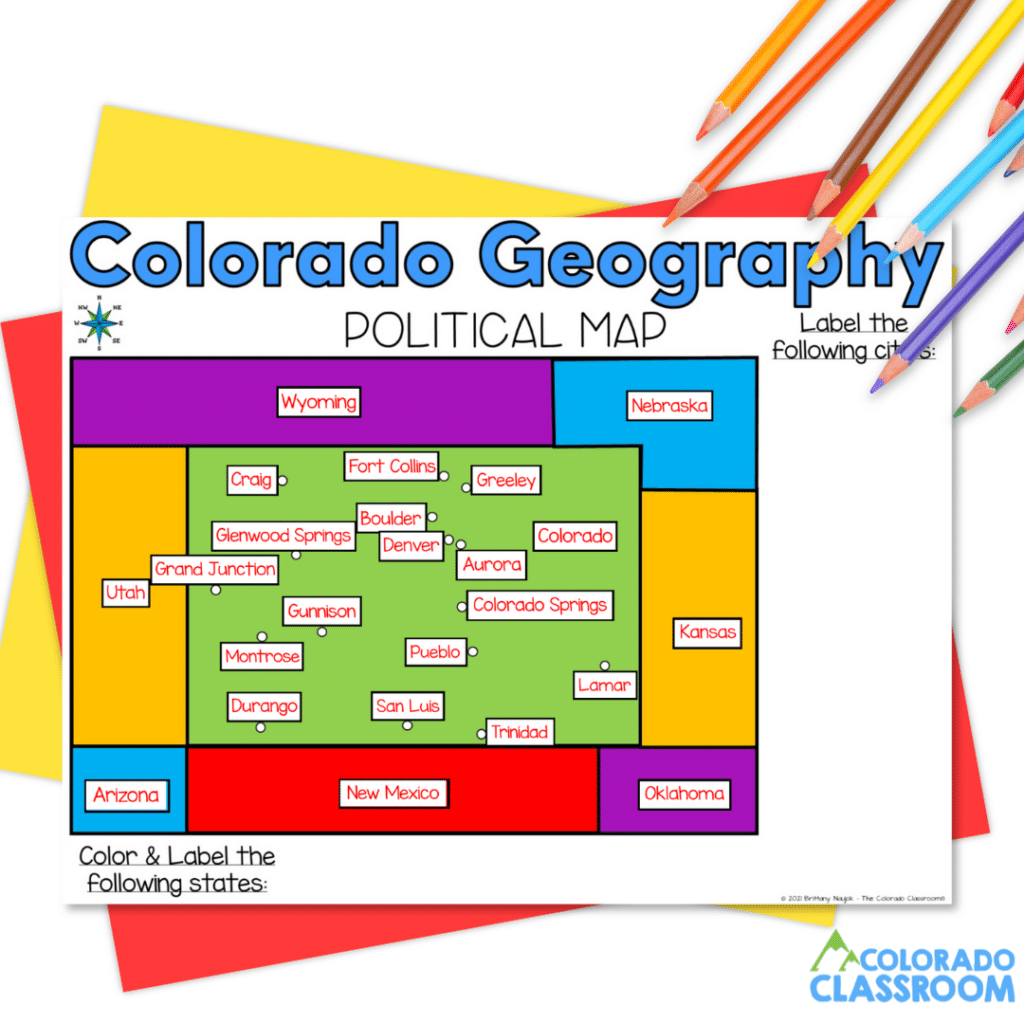
The political map activity allows our students to dive into Colorado’s state borders and neighboring areas. They color and label states like Kansas, Wyoming, and New Mexico while focusing on major Colorado cities such as Denver, Colorado Springs, and Boulder. To make it even more interactive, I have students compare these cities’ population sizes and roles in Colorado’s economy. By engaging with this map, our students better understand Colorado’s political landscape, making teaching Colorado geography more dynamic and relevant.
Physical Map
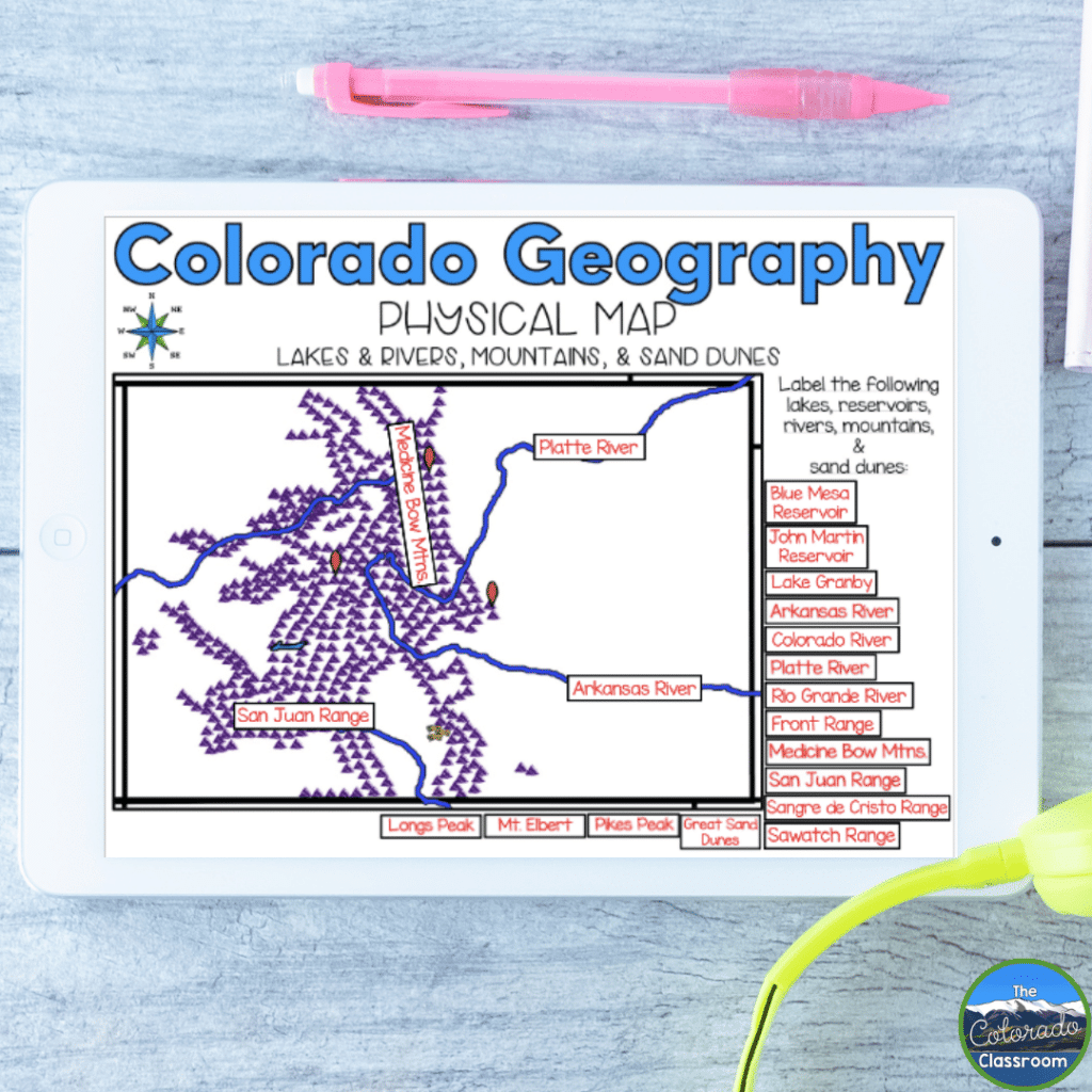
Our students get creative as they work with the physical map, highlighting Colorado’s natural landmarks. They identify and label rivers like the Colorado and Arkansas, mountain ranges like the Sangre de Cristo Range and Sawatch Range, and unique features like the Great Sand Dunes. As they color and annotate their maps, I encourage them to consider how these physical features influence farming, tourism, and transportation. This activity makes teaching Colorado geography an experience that shows our students how the state’s geography impacts its way of life.
Thematic Map
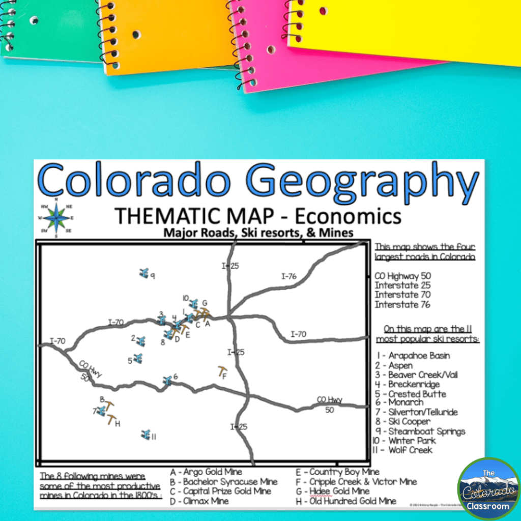
Here’s where geography becomes truly thought-provoking. In this activity, our students analyze thematic maps highlighting Colorado’s economic aspects. They look at the locations of historical mines, major roads, and ski resorts. After labeling and coloring these features, they answer questions like, “Why are mines and ski resorts often located near each other?” and “If you were to build a new road in Colorado, where would it go and why?” This activity challenges our students to think critically about the relationship between geography and human activity. This helps to solidify the importance of teaching Colorado geography through real-world applications.
National Parks and Monuments
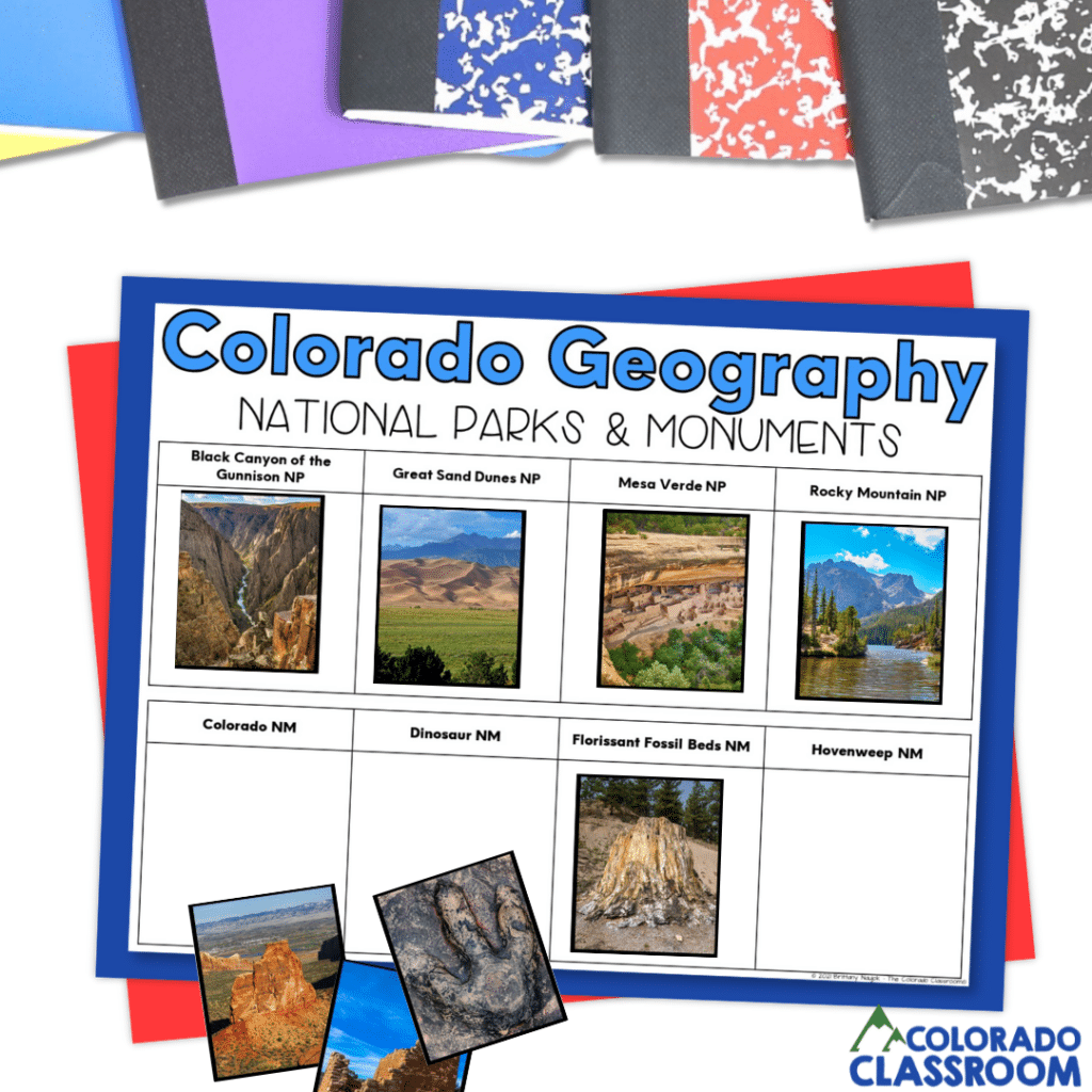
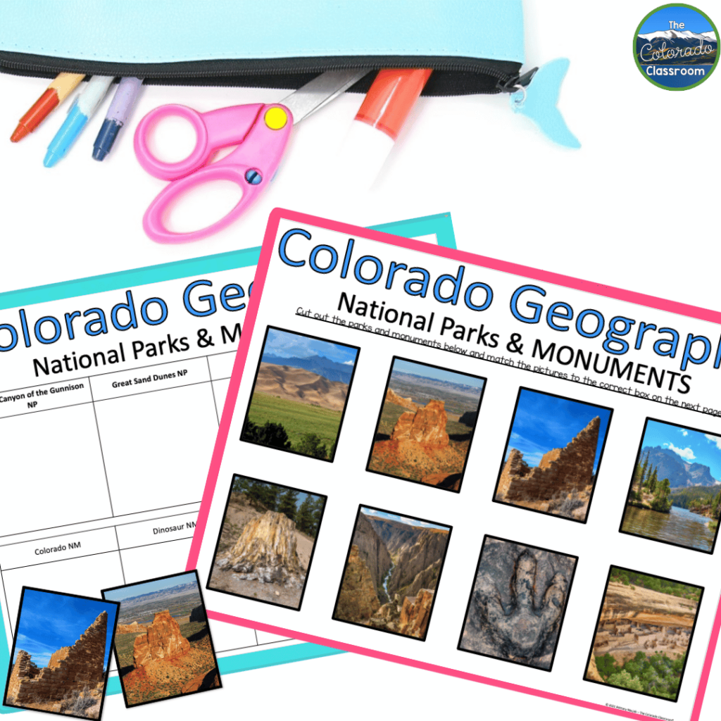
Colorado’s national parks and monuments are some of its most breathtaking features. This activity lets our students explore them in detail. They start by reading about parks like Mesa Verde, Rocky Mountain, Great Sand Dunes, and monuments like Dinosaur National Monument and Florissant Fossil Beds. Then, they label these locations on a map and match descriptions to pictures. We discuss how these natural and historical sites reflect Colorado’s diverse geography to deepen their understanding. Activities like this one, with real photographs of the locations, make teaching Colorado geography more memorable so our students won’t forget.
Military Bases
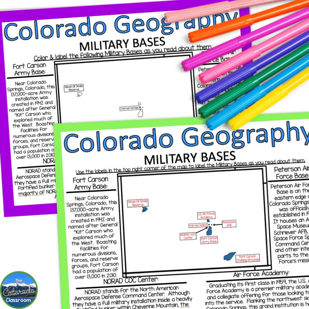
Colorado’s military history comes to life in this activity as students focus on labeling and coloring maps of major bases like Fort Carson and Peterson Air Force Base. They learn about the roles these installations play, from housing divisions of the Army to serving as the headquarters for the Space Force. We also talk about the importance of NORAD’s location in Cheyenne Mountain. We tie in how geography provides strategic advantages. This activity shows our students another layer of Colorado’s story, making teaching Colorado geography even more thorough.
Indigenous People
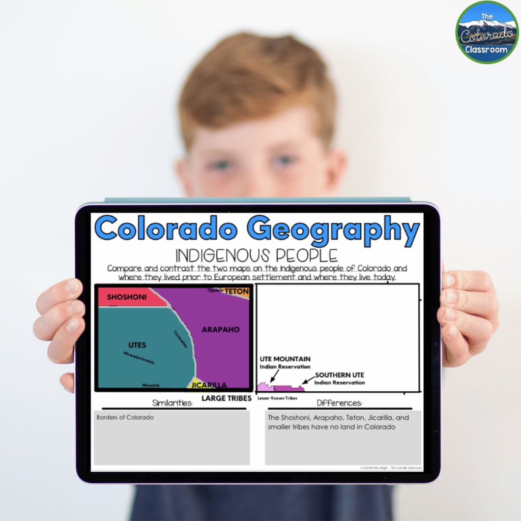
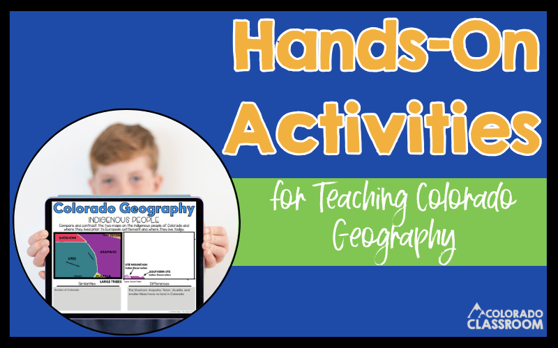
This activity is one of my favorites because it combines history with geography. Our students compare two maps: where indigenous peoples lived before European settlement and where they reside today. They color these maps and identify tribes like the Utes, Arapaho, and Shoshoni. Then, they compare the maps to see how borders and territories have changed over time. This activity teaches geography and fosters a deeper appreciation for the cultural history of Colorado. This activity makes teaching Colorado geography a meaningful and reflective experience.
Teaching Colorado Geography Lays the Groundwork
Teaching Colorado geography doesn’t have to be just another subject to check off the list. It can be an interactive experience that excites both you and your students! By using hands-on activities and connecting geography to Colorado’s history, culture, and environment, we can help our students truly understand and appreciate the world around them. I hope these ideas inspire you to bring Colorado’s geography to life in your classroom. With the right tools and activities, your students will explore, analyze, and connect like true geographers. Happy teaching!
Additional Resources for Colorado
Now that we’ve explored these hands-on activities for teaching Colorado geography, it’s time to dive even deeper into Colorado’s rich history. Below, I’m sharing some of my favorite resources and ideas for Colorado history that is engaging and memorable.
- Colorado State History: Authentic Learning By Teaching Timelines
- History of Colorado: Forging a Rich Tapestry with Diverse Groups
- 10 Engaging Activities to Teach Colorado Government to Students
Save for Later
Remember to save this post to your favorite Social Studies Pinterest board for quick access to these resources to make your teaching Colorado geography engaging!
